The old house.

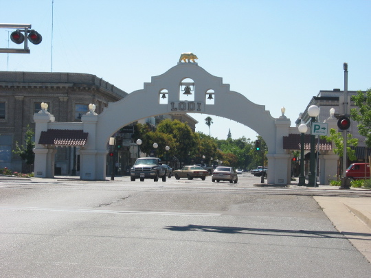
The town's landmark, the Lodi Arch.

The old house. |

The town's landmark, the Lodi Arch. |
|
We spent two days and nights at Silver Lake, just below Kit Carson Pass. The second day,
we hiked the 7-mile round trip to the top of Thunder Mountain, which rises sharply
above the lake. The next day we kayaked in the morning and then headed out for Nevada
via Lake Tahoe.
|

|
 Carol with volcanics on Thunder Mt. ...
|
 ... and at the summit (cold and windy) with Silver Lake below.
|

Nevada was, well, bleak after the Sierras. We took a quick side trip through Virginia City (Drew had never been there), then we camped at Berlin-Ichthyosaur State Park, where there is a large concentration of ichthyosaur fossils which were discovered by miners working nearby gold mines. We also stopped by a petroglyph field, Sand Mountain and its old Wells Fargo station, and Spencer Hot Springs outside Austin. Then we pushed on for Chaco, via southeastern Utah.
 Chaco Canyon


|

|

|
Chetro Ketl from the cliffs to the north. Perspective causes the back wall to look curved in this mosaic, but in fact it runs straight for about 400 ft. Some claim it is aligned with the maximum lunar rising point.

|
(left) Interior rooms of Pueblo Bonito, showing 3 floors. The
rooms must have been relatively dark, and in fact there is little evidence to indicate
most rooms were actually lived in. The masonry-work (in sandstone) is impressive.
(below) View of Pueblo Bonito from the low
clifts to the north.
Stonework at Wijiji (right). |

Petroglyphs between Chetro Ketl and Pueblo Bonito. |

The Great Kiva of Casa Rinconada. |

|
Carol standing under the skylight in the restored Great Kiva of Aztec Ruins NP.
This restoration is somewhat questionable in accuracy
(especially the yellow tape and orange cones), but nevertheless must give some feeling
to what these structures were like inside. I found that after spending half-an-hour
inside, re-emerging into the world above-ground was quite startling and impressive.
Aztec is located north of Chaco and it was built somewhat later. |

Drew with ancient bristlecone pine on Wheeler Peak, Great Basin National Park. One of these organisms is 3300 years old; the other merely looks it. |

|
The trip was fun, but much too short!